I have a confession: I am terrible when it comes to reading topo maps. I think they are amazing tools, I like looking at them, I can glean some information from them, but when it comes to actually using them, I am an adamant beginner!
I decided it was time I got some education, so I called my friend Julie Perry. Julie is an avid outdoorswoman, counselor, and former wilderness therapist. As part of her wilderness therapy job she went on recon missions checking topo maps for accuracy, because as I learned, they are not as accurate as I imagined!
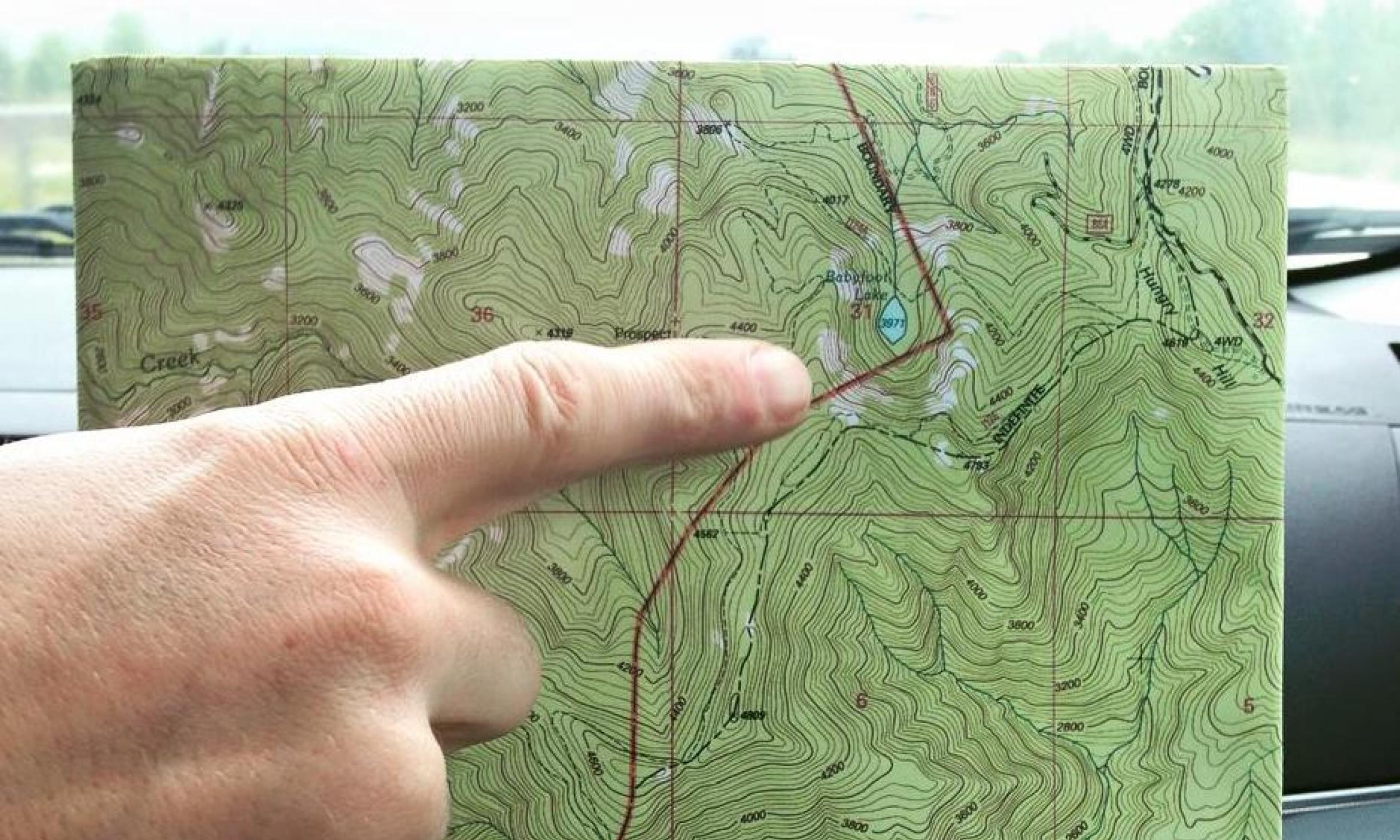
Julie came over to my home one evening and laid down a map from the Alpine Lakes Region here in Washington. She asked me to look over the map and tell her what I noticed. I could see blue lines that were creeks, I could see the contour lines that I knew indicated elevation gain or loss, there were roads and lakes, and trails. I could tell where there were peaks. But it still felt totally unfamiliar, like exploring a species I know nothing about.
She described some important things to consider when reading a map. I share them with you and urge you to put them to use as soon as possible! (Note: it will be useful if you have a topo map to look at. Go ahead and grab one. We’ll be here when you get back.)
- Always consider the date that the map was created. The map we were looking at was from 1982. Knowing that the map is 28 years old is important because, as we all know, nature shifts over time. Trails get wiped out, springs vanish, and reappear elsewhere.
- Know your Contour Interval. This is found towards the bottom of the map and tells you how many feet are between each contour line. The map we were gazing upon had an 80-foot Contour Interval. Julie made sure to let me know that if anything on the actual landscape was under 80 feet, the map makers were not required to put it on the map. So a 79-foot waterfall or a 50-foot sheer cliff may not be found on the map. She laughed as she remembered coming across this many times and having to use her smarts and creativity to find a new route. She suggested talking with locals before heading out on a bushwhacking trip!
- When you are reading a topo map at home, perhaps practicing your skills, envision the landscape. Ask yourself if I look in any direction what am I seeing? And keep shifting from the detail picture to the bigger picture, using your imagination. This will pay off when you are in the actual location of your map.
- Learn to recognize elevation gains and decreases quickly. This will be a great aid when you are on the move. For instance, know that the contour lines form V’s around creeks and the point of the V always points upstream. Again shifting from the small to the large perspective will help with this. And keep exploring the contour lines, read the actual numbers on them, they tell you what the elevation is!
Here is some other cool info: topo maps are made from aerial photographs, but we don’t know what time of year the photos were taken. If a photo was taken in the winter, when there tends to be more water, a stream may show up on a map that in July is virtually non-existent. And vice versa. Also, there are areas that are shaded green and areas that are shaded more white or dotted green. The white or dotted green areas indicate that there is not enough vegetation to hide 40 men plus artillery! Again, this can shift over time, so know the date of your map.
Finally, I want to hit up declination. Declination is the difference in degrees between Magnetic North and True North and in terms of map and compass work you need to know the declination of the exact area where you are traveling. If you don’t and you were to walk 10 miles in Washington State without using declination you would end up 3 miles off target, which is definitely not what you want, especially if you are lost! So take some time and understand this concept.
I am by no means now an expert map reader. There is just so much to learn. I now have identifying field marks, basic understandings, and a reminder that Mind’s Eye work never ends and only improves all situations! So get yourself a topo map or two of your area and start exploring. This is a great way to keep your skills up over the Fall and Winter!